Learn about the 2045 Unified Plan!
Read MorePlanning and Development

Need a permit? Access the County’s portal for Zoning, Inspections, and Permitting.
Apply here
Opening a new business? Submit occupation tax applications using the County’s Business Tax Portal.
Submit Application
Updated Alcohol Licensing Procedures
Learn More Notice: Effective January 1, 2025, and pending further direction from the court, the city of Mulberry will be responsible for all planning, zoning, code enforcement, permitting, and business licensing activities within the city limits pursuant to the city of Mulberry’s Letter of Intent.
Learn more from Planning and Development.
Read the County’s statement regarding the provision of services within the city of Mulberry.
Learn more from Planning and Development.
Read the County’s statement regarding the provision of services within the city of Mulberry.
Programs & Services
About Planning and Development
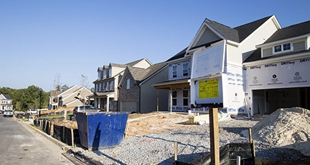
The Department of Planning and Development serves to promote and enhance the well-being of residents and businesses in Gwinnett County by planning for growth and maintaining adopted standards for development.
The department consists of the Planning, Infrastructure Planning, Development, Building, Customer Experience, Code Enforcement, Administration, Economic Development, and Housing and Community Development Divisions and is responsible for community planning, authorizing permits for site development and building construction projects, issuing business licenses, and enforcing county codes and ordinances.
The department strives to provide an elite level of service to each resident and business. For added convenience, customers can access services pertaining to zoning, inspections, and permitting by visiting the ZIP Portal.
Please visit Municode to access the department’s codes and ordinances.
View the department's fee schedule.
Planning and Development is committed to meeting the needs of its customers by providing timely and quality service. Please let us know how we are doing by completing a brief Customer Service Survey.Vision, Mission, and Values
Vision Statement
Gwinnett is a sustainable, inclusive, and connected community that is a highly desirable place to live, work, and do business.
Mission Statement
Planning and Development continues to elevate our approach to planning for growth and delivering services through innovative, people-centered strategies.
Values Statement
The department’s core values define our workplace culture and influence the relationships we develop with our customers and residents through:
- Excellence
- Integrity
- Transparency
- Collaboration
- Continuous Improvement
- Accountability